Area of expertise of the Hydrographic Service
The Hydrographic Service produces nautical charts of the Netherlands Continental Shelf, and of the waters in the Caribbean part of the Kingdom. If military operations are being carried out, the Service advises navy vessels and submarines on safe shipping routes and weather conditions in the area of operations.
2 ships
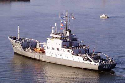
Hydrographic Service personnel monitor changes in the seabed and the consequences for shipping lanes on a daily basis. For this work, they have 2 vessels at their disposal: HNLMS Luymes and HNLMS Snellius. These are the hydrographic survey vessels of the navy.
Cooperation
The Hydrographic Service takes part in international cooperation in the International Hydrographic Organisation (IHO) in Monaco. In the Netherlands, the Service cooperates closely with the Netherlands Directorate-General for Public Works and Water Management in a federation called the Netherlands Hydrographic Institute (NHI).
Standards for hydrographic surveys
Together with the Netherlands Directorate-General for Public Works and Water Management, the Service has developed national standards for hydrographic measurements which complement the international standards, the so-called IHO Standards for Hydrographic Surveys.

